
Heading East
I haven’t worked on photography for my Small Towns project in a long time…at least a year, though it hasn’t been far from my mind. I have been working on a different project (Cartomancy), which is more local and more editing-oriented, but with the fires I have been thinking about the small towns in the Cascades, and Eastern Washington.
We have been worried on Vashon this summer, as it’s been dry, and like so many towns, our history holds bad and large burns. In town after town I visited, I saw plaques, or signs, or murals about past wild fires and forest fires. Concrete Washington makes concrete, but they also built their town out of concrete to withstand fires, after a fire. It’s why so many towns built their important buildings out of materials to better withstand fire.
I had never photographed the fires that burn every year, or the aftermath, though I’ve stayed up late and worried over fires approaching some of my favorite towns, so I thought we would head out (now that the fires are mostly out in our area) and see what I could see. Without a high vantage point, the photos of the burned areas don’t capture that the burned areas often stretch as far as you can see in all directions. And some of the details (warped metal guardrails, the all new electric poles and lines, for miles, homes and farm machinery burned and broken, the scorched road) looked and felt wrong. Dramatic without being interesting or specific, and preying on others misfortune.


Instead we have the view from the ferry dock this morning, the smoke and the red sun. A Roslyn property line.
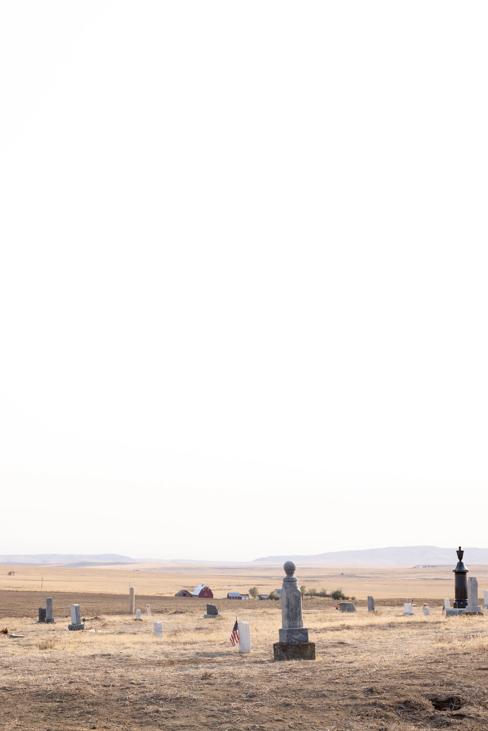
Excerpts from the Roslyn cemeteries - in theory there are 26 separate cemeteries in one cemetery district (when that area was used, and different Lodge affiliations, professions, races, and where people immigrated from), but there are lots of ways to sell the idea of a segregated cemetery.
A house and outbuildings in Waterville. Driving through I saw that the old auto dealership had apparently burned, and then was knocked down, and that our old favorite cafe is not only closed, but one of the owners has died - I took a photo there of his kitchen a few years back, with my hash browns cooking, and he and his wife told us about their son, a doctor who was at University of Washington, and why the local school team is called The Shockers.
Then we drove from Farmer to Bridgeport, and back on a different set of roads, where we saw lots of burnt land and buildings, and visited the Farmer Cemetery, in Farmer Washington. And back through Waterville for the last shot, on our way to our Wenatchee hotel.
We talked to no one, the whole time, though I did wave at the dam security patrol man a few times while we were near the dam overlook. Checking into our hotel I was happy to see lots of mask signs, and masks on the front desk people. A lot of rural towns and counties are politically conservative, and I was worried about an anti-mask free for all, but picked a chain hotel with less cheap rooms that I usually like to go to, rated high for cleanliness, because the last thing I want to do is get sick. Not that cheaper places are more likely to be infectious, really, but I know that the places I most like to stay because they have character, are often more fun because of the interesting people, and I am swearing off people for now.
So far the trip, and my good company - my teenager - have been a just great. I’m glad we got to do this together, and I’m so happy to see new things, and old things. I’ve missed the continuity of space and time, and the feeling of driving almost endlessly. It’s one of the best ways for me to clear my mind, to drive for hours, and I don’t get the opportunity much anymore. Plus these roads! Long and in decent condition, with light traffic…ahhhh!